
The Geography Drawing Series: It’s Fun and Effective
Is geography one of those subjects that you teach just because you should? Never really expecting your students to learn. It doesn’t have to be!
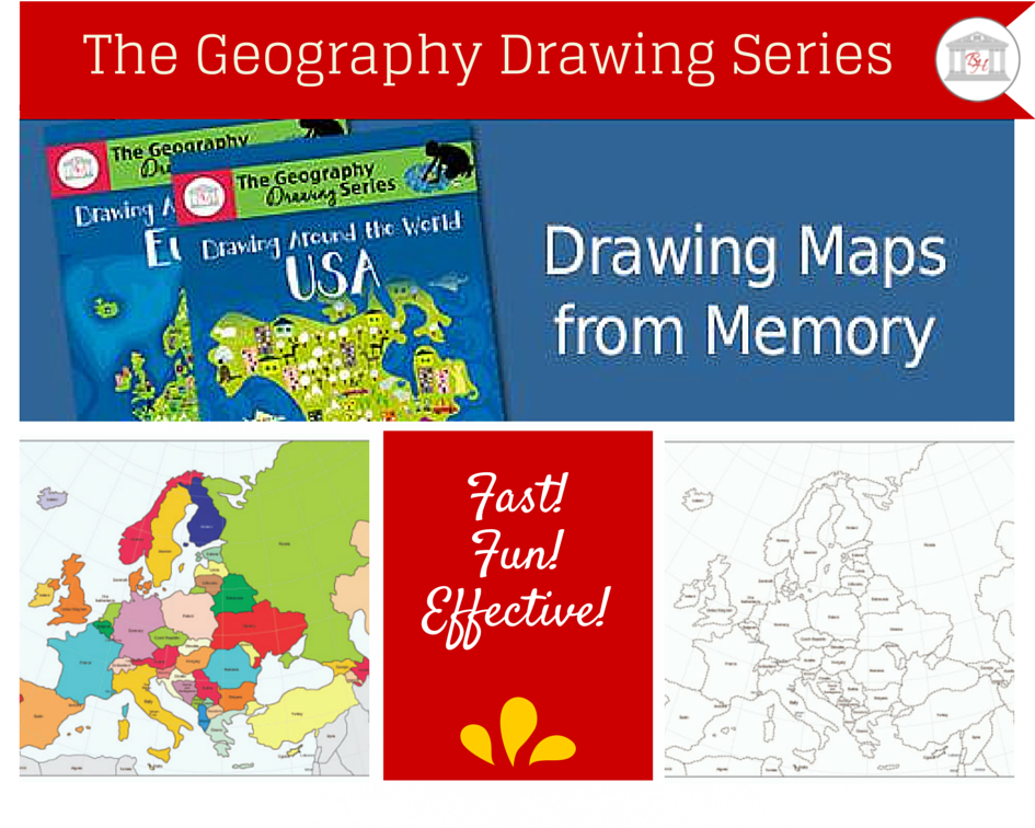
Introducing: The Geography Drawing Series!
The Geography Drawing Series is a simple, yet extremely effective curriculum that teaches children geography.
Finally, with the Geography Drawing Series, you don’t have to wonder:
- How are you going to coordinate history with geography?
- How are you going to make time for geography?
- Are your students really learning geography as they trace routes and identify locations on a map?

The Geography Drawing Series: The Solution to Teaching Geography
How are you going to coordinate geography with history?
You won’t! Your student will!
Sometimes we over think and over teach. And when we do, we risk taking the joy of discovery away from our students.
That’s one of the many benefits of The Geography Drawing Series. If the student has memorized the countries of Europe, and is reading about the travels of Marco Polo, he can easily imagine the route in his mind.
And when he sees the route on paper, it will actually make sense.
How are you going to make time for geography?
With this book, geography and history are separate. You can now fit geography into your schedule whenever it suits your families’ needs! In only a few minutes a day, you can do geography anytime.
Are your students really learning geography as they trace routes and identify locations?
If your students are like mine, the answer is no. Students don’t have to trace routes with The Geography Drawing Series. They are going to learn geography by actually learning geography. No more random lines that students forget as soon as they put their pencils away.
(You ever wonder why route tracing doesn’t work? It’s because it’s too much detail given too early. As teachers, we think it’s easier for children if we teach less. So we teach bits and pieces of random facts without giving our children a big picture framework first. When they understand the big picture, the details are easy to learn, easy to understand, and easy to remember.)
The Geography Drawing Series Learning Objective!
To help students learn the names and relative positions of the European countries, students are asked to illustrate, from memory, the individual countries and their locations.
“Question: What if my students aren’t studying Europe?”
Answer: No problem! Keep reading. Drawing Around the World: USA is also available!
Although this is a geography curriculum that utilizes drawing, it is not a drawing curriculum. Students are not expected to recreate the countries to scale. Nor are they expected to perfectly recreate the shapes of the countries.
Students are, however, expected to create a map that demonstrates their amazing new knowledge of European or United States geography.
“Upon completion of this program, students will have
a dramatically increased knowledge of the world.”
The Geography Drawing Method
Each week students study one to four new countries or states. As they do so, they become familiar with the geographical shapes by tracing them, locating them on a map, and labeling them. To give students an opportunity to learn interesting facts about each individual country, they are asked to complete a country fact table, documenting each countries’ population, cultures, major religions, climate, and resources. (And if students are learning the United States, they complete a state fact table. )
To complete the Geography Drawing program, use either of the free resources or the text below:
If studying European Geography,
Free online resources:
- World Fact Book CIA Geographical information–Very Thorough!
- Prayercast A Religious Website: Learning about and Praying for the Countries of the World
- Sheppard Software Containing European Geography Information
or from amazon.com the following text: (Not necessary if using either of the free sites above)
If studying United States Geography,
Free online resources:
- 50states.com Information on the states and capitals
- Sheppard Software United States geography information
or the following text: (Not necessary if using either of the free sites above)
The Geography Drawing Series Weekly Schedule
- Day 1: Study the New Country or State.
Complete the Fact Table.
Locate and label each new location on the dashed, black and white map.
Draw all of Europe or the United States that has been studied thus far.
- Days 2, 3: Locate and label each new location onto the dashed, black and white map.
Draw all of Europe or the United States studied thus far.
- Day 4: List, from memory, all locations studied thus far.
Draw and demonstrate, from memory, Europe or the USA.
Additional Geography Memorization Techniques:
- Coloring Pencils
Have students use coloring pencils to color as well as trace the countries on the dashed, black and white map. (Days 1, 2, 3, or 4.)
- Drawing Fun Pictures
On Day 1 encourage students to make a picture out of the individual country drawing. This will help many students to remember the country’s shape.
- Timed Drills
Drills are an extremely effective practice. Drills can help children memorize large amounts of material in a short amount of time. When engaged in timed drills, children often consider the activity to be more challenging and more fun.
Conduct the first few drills without a timer. This will help you determine how much time to give students during timed drills.
- Extra Drawing Practice
As your students learn to draw the individual countries, you may find that they need additional practice. If so, regular old plastic sheet protectors and dry erase markers are a fast, fun, and easy way to give your students more practice drawing.
To use the sheet protectors, place the day’s work in sheet protectors, and encourage your students to use dry erase markers to complete the drawings. This will allow them, with very little effort, to quickly draw and erase their illustrations several times, giving them as much practice as possible.
- Memorizing the Countries
If following the schedule provided on page vii, you will notice that on Day 4 students are first asked to list all of the countries they have learned before drawing them onto the blank text box provided.
“With The Geography Drawing Series, students are taught
to memorize and draw large parts of the world from memory!”
Ready to see Drawing Around the World: Europe?
Drawing Around the World: Europe
Not studying Europe? Check out Drawing Around the World: USA!
(Please note: The above links to amazon contain affiliate links.)